

Event-Driven Low-Power Capture
Wake the device by PIR, GPIO, or schedule to capture only when visual data is needed.
PIR / GPIO TriggerDeep SleepScheduled Wake

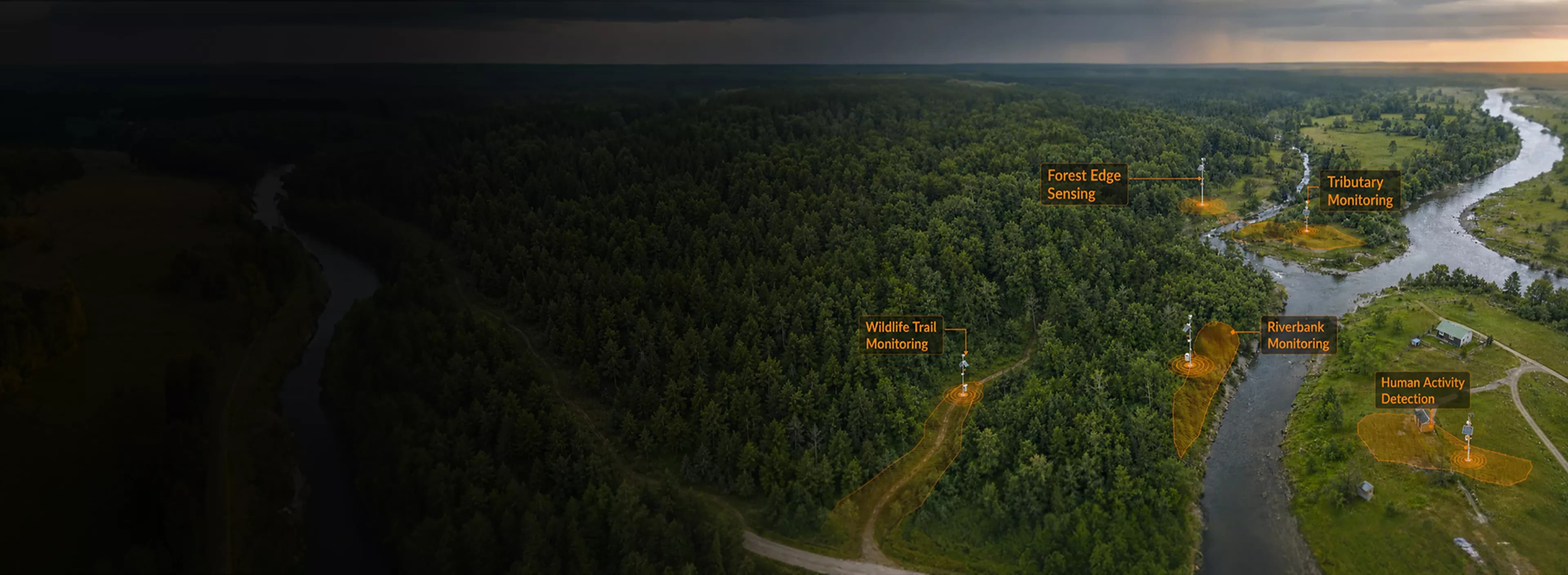
Deploy CamThink edge AI cameras, low-power sensing nodes, and AI gateways to capture visual evidence from remote field sites across wildlife, water, land, agriculture, waste, and environmental scenarios.
Remote field sites change in ways that numbers alone cannot explain. Wildlife movement, water conditions, crop stress, smoke, waste, and site anomalies all need visual context before teams can verify events and act with confidence.
A reading can show that something changed, but not what caused it. Field teams still need images to verify water conditions, animal activity, smoke, waste, or site anomalies.
Remote sites are costly to visit and hard to cover frequently. Visual capture nodes help teams observe more locations without constant field trips.
Always-on video is often impractical in remote environments. Event-triggered and scheduled imaging capture only the moments that matter and reduce power consumption.
CamThink devices capture the field moments that matter, run edge AI when needed, and output images, alerts, or structured event data to your platform.
Wake the device by PIR, GPIO, or schedule to capture only when visual data is needed.

Capture images at fixed intervals for water level, land condition, crop status, habitat change, and site records.

Run detection or classification on the camera node or edge gateway to reduce raw data transmission and send only useful results.

Update models, firmware, capture schedules, and device configurations remotely across deployed nodes without visiting each site.

Send labels, timestamps, confidence scores, alerts, device status, and optional image evidence to your platform.

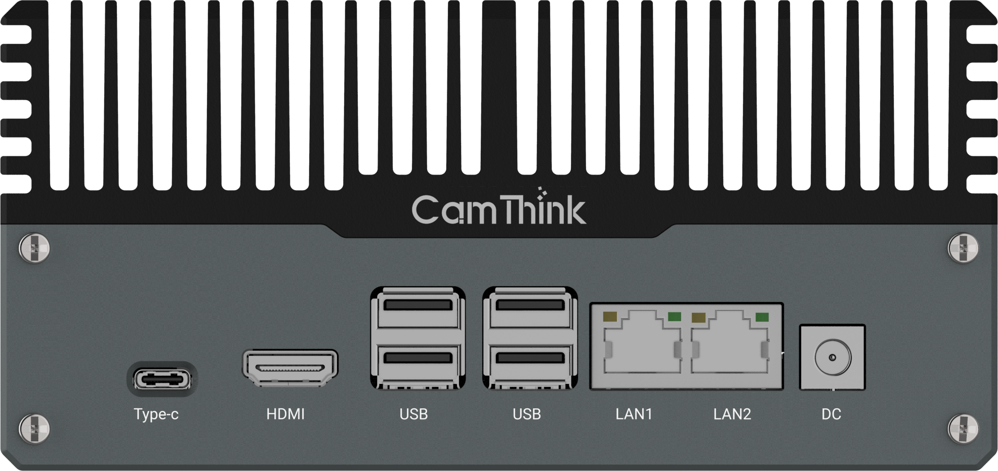
Support LTE, Wi-Fi, Wi-Fi HaLow, or PoE for different site conditions, distance ranges, and deployment architectures.
Remote field sites differ by coverage area, power access, network conditions, and AI workload. CamThink helps teams match those constraints with a practical deployment pattern, from standalone nodes to gateway-based coverage and hybrid monitoring architectures.


Across wildlife, water, land, agriculture, waste, and environmental risk monitoring, CamThink edge cameras capture visual evidence and convert field events into structured outputs your platform can use.

Detect animal presence on trails, habitat edges, or remote corridors. Event-triggered capture helps avoid continuous video while preserving image evidence for review.

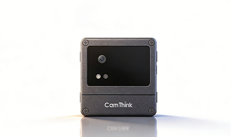
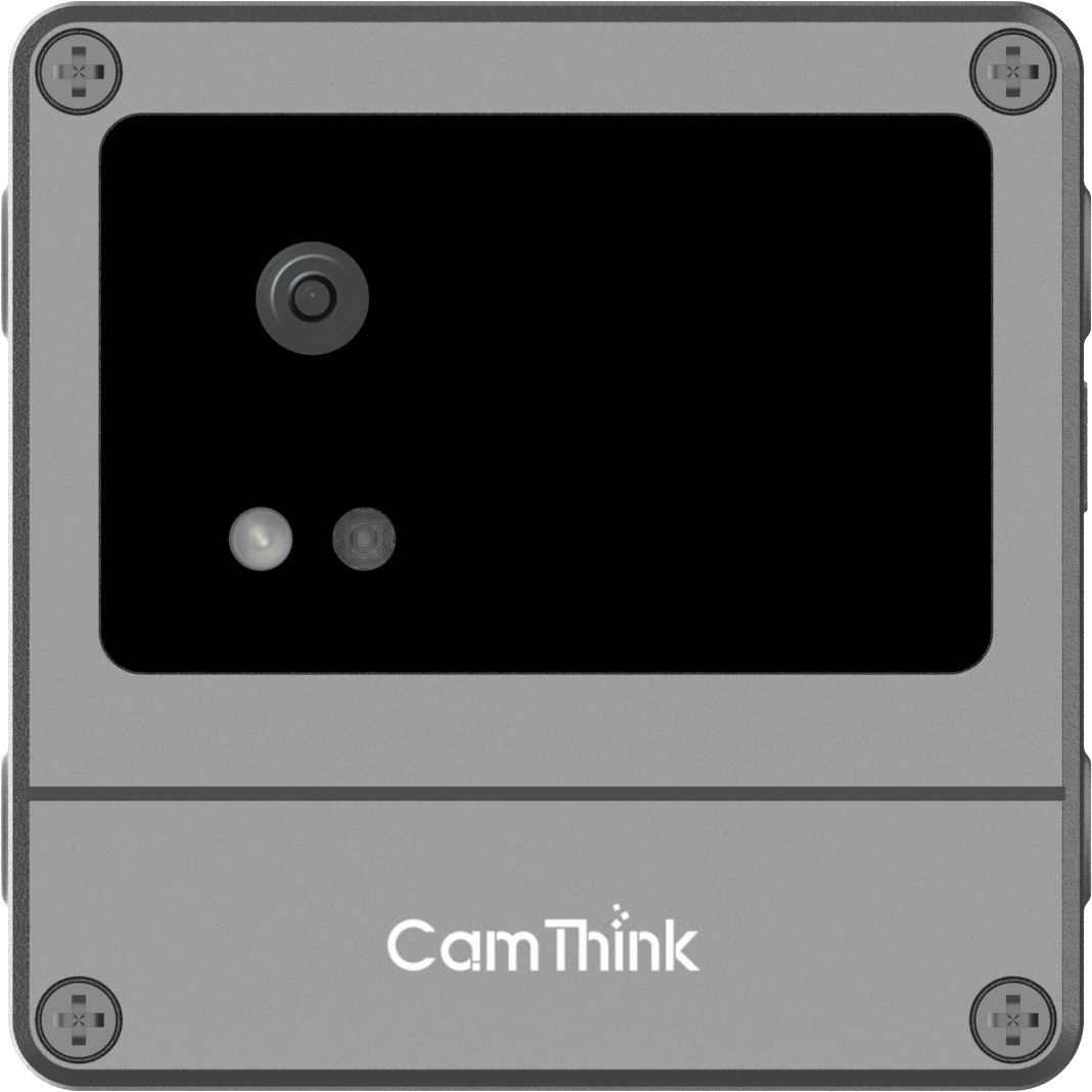
Use NE101 for event-triggered or scheduled visual capture at remote monitoring points. It is suited for long-term field deployment where low power consumption, simple event output, and flexible connectivity matter most.
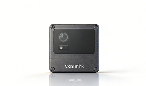
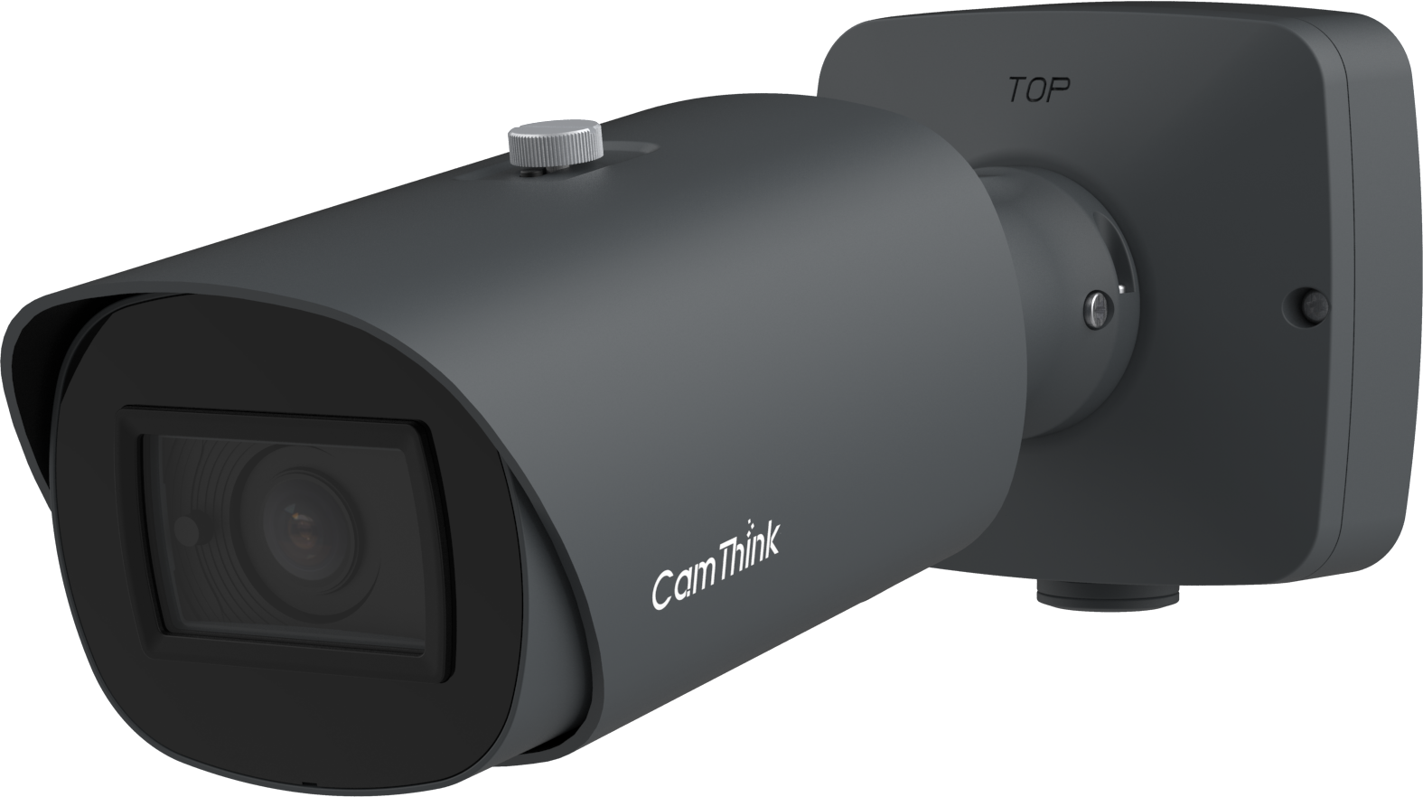
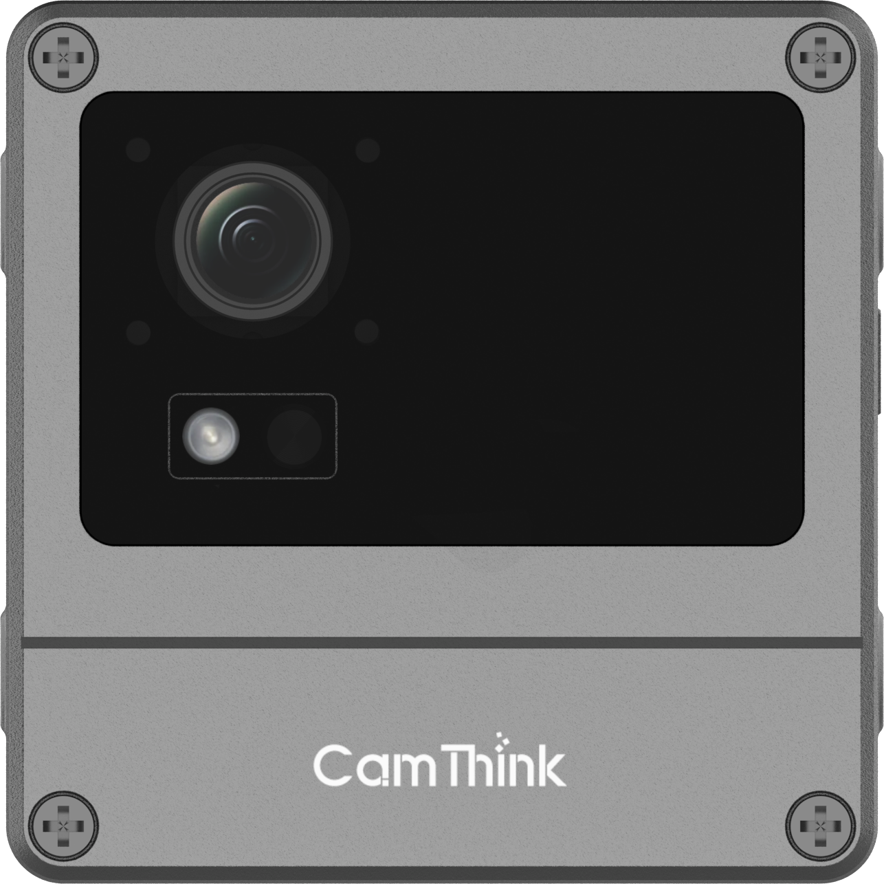
Use NE301 when the field node needs on-device AI detection or classification. It supports outdoor deployment, battery, solar, or PoE power, and remote model updates for visual AI workflows.
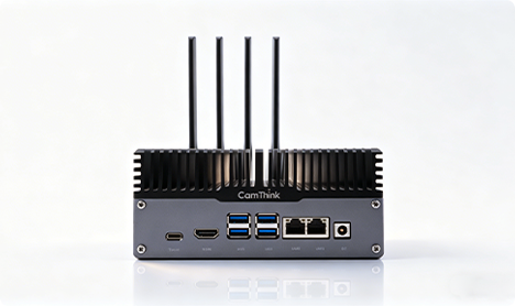
Use NG4500 when multiple field nodes need to be aggregated at one site. The gateway handles heavier AI workloads, cross-node processing, and structured uplink from larger monitoring areas.
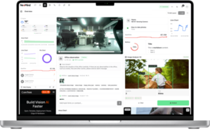
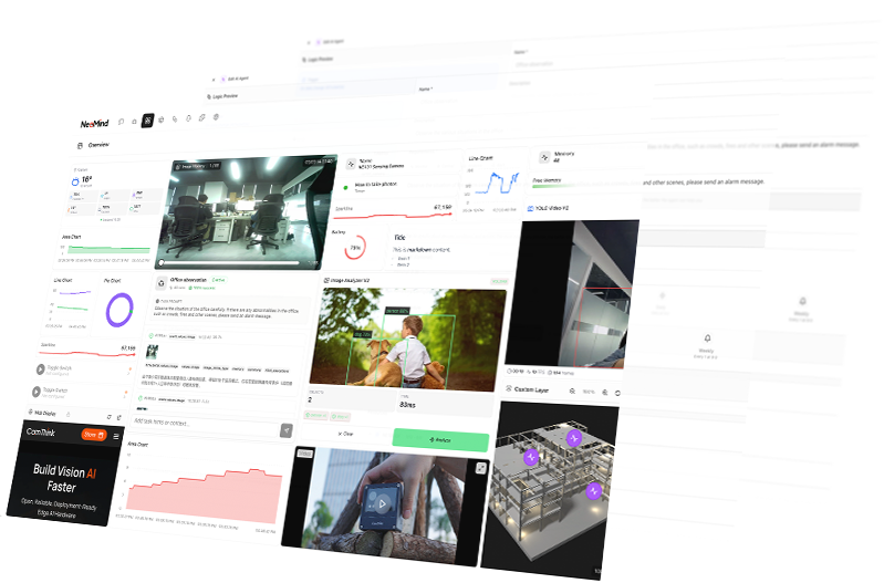
Centralized platform for remote field monitoring fleets. Manage device status, OTA updates, event data, alerts, and AI-assisted workflows across wildlife, water, land, agriculture, and environmental monitoring sites.
Talk to our team about your site conditions, monitoring targets, connectivity requirements, and expected deployment scale. We can help you choose the right hardware mix, architecture, and evaluation path. Or email us directly at sales@camthink.ai
Order evaluation units to test integration, AI performance, and power behavior before scaling.
Review firmware architecture, APIs, MQTT payloads, GPIO interfaces, and NeoMind integration guides.
Edge AI guides, product updates, deployment tutorials, and environmental monitoring case studies.
Order evaluation units to test integration, AI performance, and power behavior before scaling.
Go to StoreReview firmware architecture, APIs, MQTT payloads, GPIO interfaces, and NeoMind integration guides.
Open DocsEdge AI guides, product updates, deployment tutorials, and environmental monitoring case studies.
All articles


