Use existing CCTV to estimate parking space or zone occupancy where the camera views clearly cover the target areas. This guide shows how to choose the measurement, turn local AI output into parking platform events, and validate a focused PoC.
Updated 12 min readNG4500 · NE503
By Harry Hua
In This Article
Define the Parking State the System Must Report
Short answer: Yes. Parking occupancy detection can reuse selected existing IP cameras when their views show the bays, zones, or gate lines being measured. A site-specific application on NG4500 can turn those streams into stable occupancy events for a parking platform or guidance system; NE503 can add a camera view where an essential area is missing. A focused PoC establishes which views and events are ready to use.
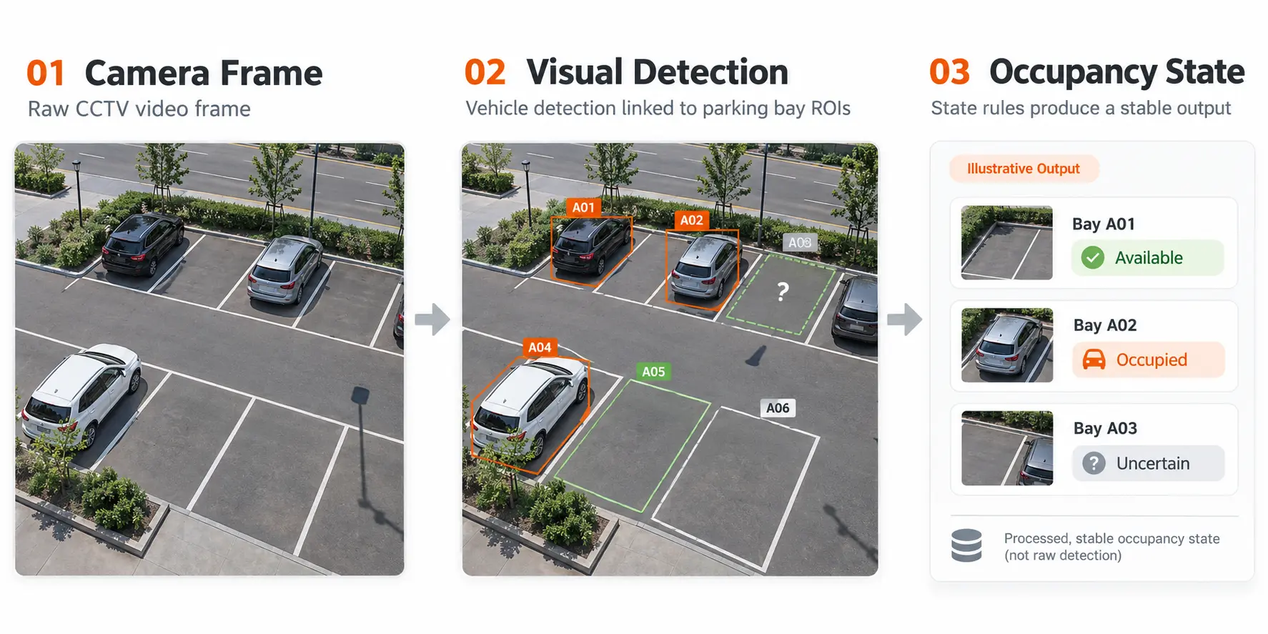
A vehicle detection box is an observation. Occupancy is a decision about a named space or area over time. If a car passes through a lane beside a space, that space does not become occupied. The site therefore needs a clear state rule before camera or model selection.
For a parking guidance sign, the decision may be how many spaces are available in a floor or zone. For a reservation or enforcement workflow, the platform may need a stable state for a specific bay. A garage with controlled entrances can also estimate occupancy from entry and exit events, but its running count needs reconciliation when a gate event is missed. These are different measurements, even if all three are described as “parking occupancy.”
Write down the operational question in one sentence: “Which spaces can I direct a driver to now?” or “How many vehicles are inside this controlled area?” Then specify the output, the update delay the operation can tolerate, and who resolves an uncertain reading. This prevents a PoC from looking successful on selected frames while failing the actual parking workflow.
Choose Space, Zone, or Entry-Exit Measurement
Measurement
What the platform receives
Good fit
Main failure to test
Individual space status
Available, occupied, or uncertain for a mapped bay
Guidance to a specific space; bay-level operations
Occlusion, ambiguous boundaries, a vehicle spanning two bays
Zone occupancy
A count or capacity state for a defined row, floor, or lot section
Directional crossing events and a reconciled running count
Controlled gates and lanes
Missed or duplicate crossings; vehicles using an unmonitored route
Individual space status is the output many buyers mean by parking space detection: each image polygon maps to a real bay ID. A parking guidance system can use those events to direct a driver to a named space. Zone occupancy supports a floor-level availability sign, while entry-exit counting estimates a total for a controlled facility. These outputs can be combined, but each answers a different operational question. A distant half-visible bay calls for a better view; a gate count cannot tell the platform which bay a driver used.
The measurements can complement one another. A controlled garage might use gate counts for a total and camera-based space states for guidance on one floor. Treat mismatches as signals to investigate, rather than quietly replacing one value with the other. Decide which measurement is authoritative for each customer-facing output before integration begins.
Map Existing Views to the Spaces That Matter
Start with a site plan and one representative frame from each candidate camera. Mark the intended space polygons, zone boundary, or counting line. Give every monitored area a stable ID that matches the parking platform. Then look at the smallest and farthest target, not just the center of the image. Perspective makes a bay at the far end occupy fewer pixels; a wide field of view can make neighboring bays visually merge.
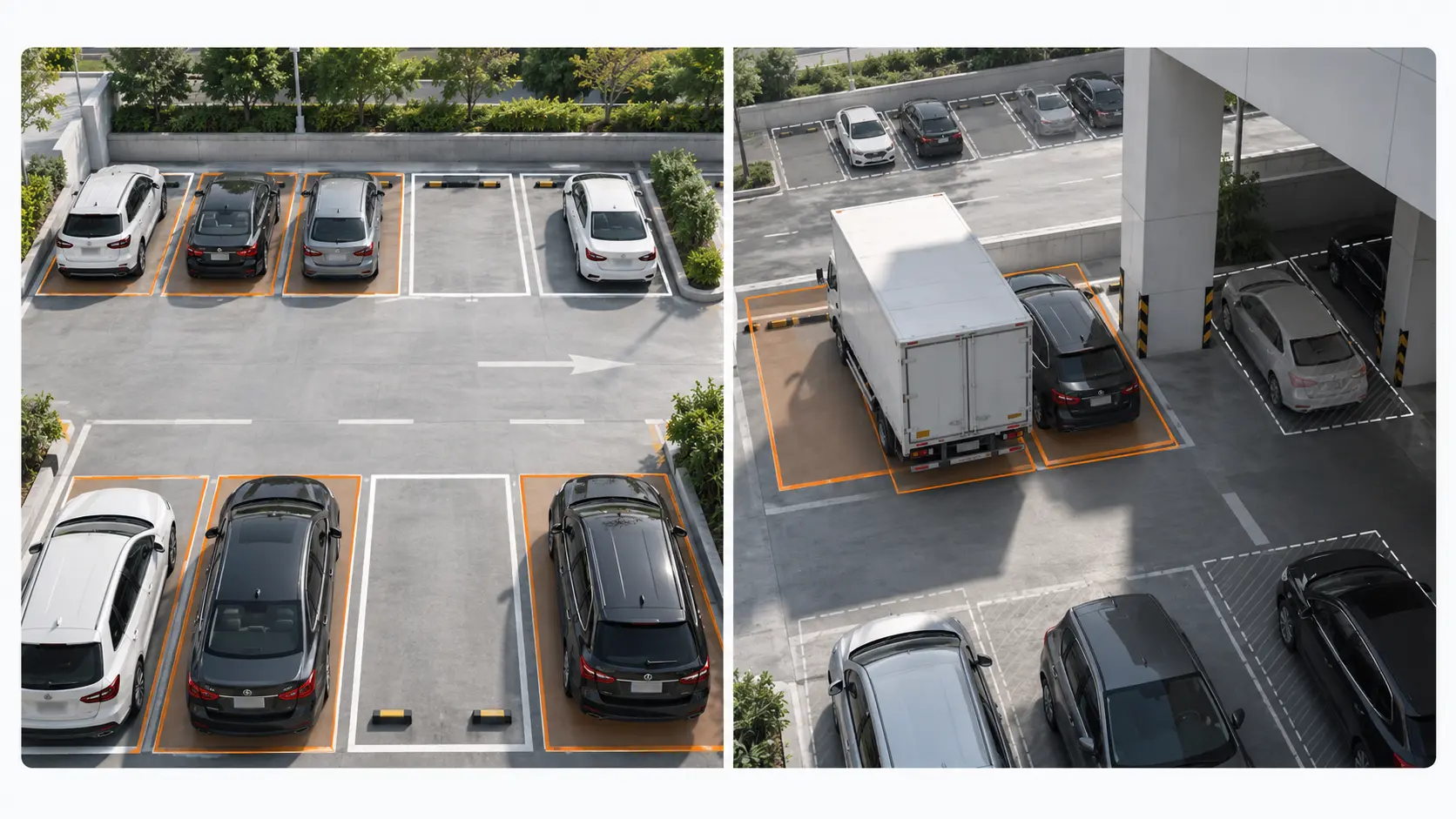
Check the view with spaces empty and full. Parked vans, pillars, trees, ramps, signs, and passing traffic can hide the part of a bay that proves its state. A roadside space may disappear behind a bus for several seconds; an indoor bay may be washed out by headlights or reflections. If the project needs an immediate “available” signal, those gaps matter more than a good daytime sample image.
Camera placement often decides which areas a project can cover. Where a column hides one row, a better vantage point can supply the missing evidence while the other CCTV views stay in service. Where many target bays are outside useful coverage, revise the camera plan before expanding the AI workload. The result of this step is a map of usable, uncertain, and missing views, with a reason and next action for each one.
Decide Whether the Installed CCTV Is Reusable
A reusable camera must provide both accessible video and usable parking evidence. Confirm that the team can obtain the intended stream from the VMS or IP camera with the required permissions, stable connectivity, and a resolution and frame rate appropriate to the state change being measured. Test the actual encoded stream that the edge device would receive; a high-quality live display in the VMS does not prove that the available substream preserves distant bay detail.
Sample the hard periods: dusk, night, rain or glare, full occupancy, turnover, and times when vehicles queue or stop briefly near a counting line. Include the farthest target and the point with the worst obstruction. Check whether time stamps are aligned across cameras and whether the view changes after PTZ moves, maintenance, or VMS configuration changes. A fixed bay map becomes invalid if the camera moves.
Separate stream problems from scene problems. A stream that drops or cannot be accessed requires an integration fix. A stable stream with hidden bays requires a different camera position or a narrower measurement. For a wider CCTV reuse assessment, see the guide to adding AI to existing CCTV systems. Use representative-footage validation before making hardware commitments if the view is still uncertain.
Build a Stable Occupancy State from Video
The application should turn observations into state transitions, rather than publishing every frame-level detection. For a bay, that means associating observations with its polygon, applying a dwell or persistence rule, and changing state only when the evidence is sustained. A car passing across the bay should not create a long occupied interval. A vehicle briefly hidden by a pedestrian should not make an occupied bay flash available.
Define the exceptions explicitly. If a vehicle spans two bays, decide whether both are occupied or whether one is flagged for review. If a motorcycle is allowed to use a full bay, include it in the occupancy policy and test it. If a van blocks the view, publish “uncertain” rather than inventing a free-space result. After a camera outage, the platform should distinguish the last known state from a current observation. These rules belong in the acceptance criteria, not in an operator’s memory.
For entry-exit counts, choose a virtual line with a clear direction and enough track length to reject a car that stops, reverses, or turns before crossing. Decide how the running count is initialized and reconciled with a physical audit. A reliable crossing detector can still produce a wrong total after a network interruption or a vehicle uses an unmonitored gate. Occupancy is an operational state with a history, not merely an inference score.
Use NG4500 for Selected Existing Camera Streams
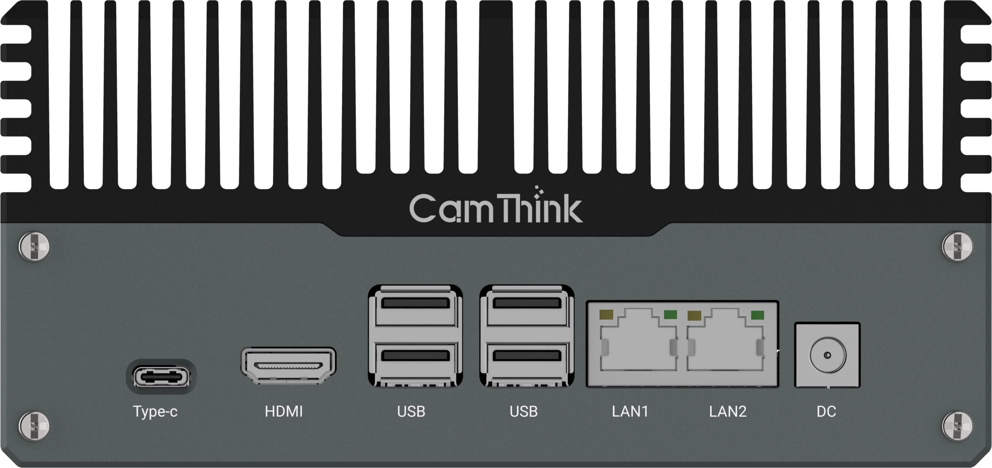
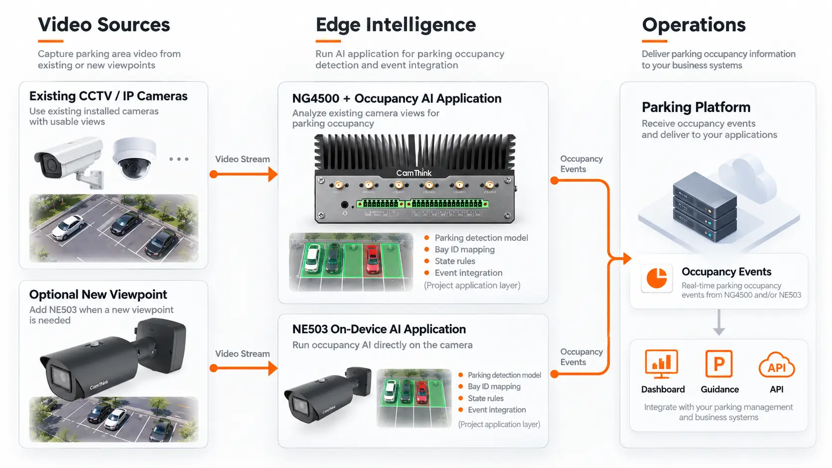
When installed IP cameras already cover the target spaces or lanes, the NeoEdge NG4500 is the primary CamThink evaluation platform. Its Jetson Orin compute can run a site-specific vision application on selected camera streams locally while the cameras remain in place. The application maps detections to bay or zone IDs, applies state rules, and sends occupancy events to the parking platform. This is a practical route to test new analytics without a site-wide camera replacement.
For example, a fixed view of a marked row can associate vehicle observations with space IDs, hold a state until the change is stable, and publish space_id, occupied, and time to a guidance platform. The platform updates a bay map or availability sign; an operator can review uncertain states. This is a reference workflow to build and validate, not a claim that occupancy software is preloaded on NG4500.
Size the deployment from the actual streams and workload: codec, resolution, frame rate, camera count, model pipeline, evidence needs, and acceptable transition delay. Start with a small group of representative cameras, measure end-to-end behavior, then expand on the basis of that result. For a candidate camera set, review an NG4500 pilot configuration with CamThink before scaling stream count. Keep the hardware, application, and parking platform roles distinct.
Add NE503 for Missing Camera Views
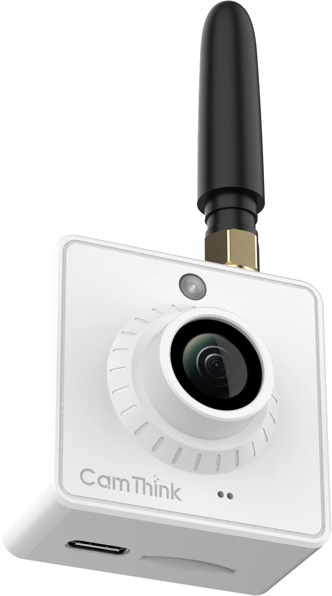
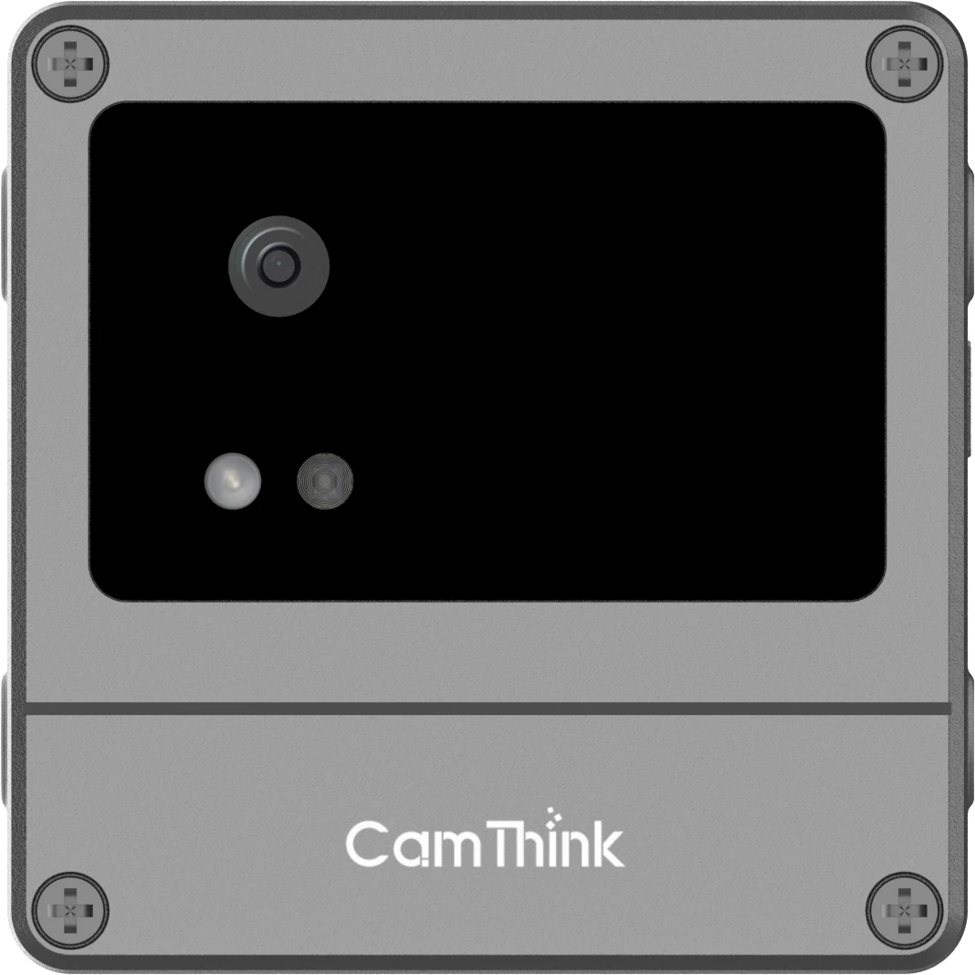
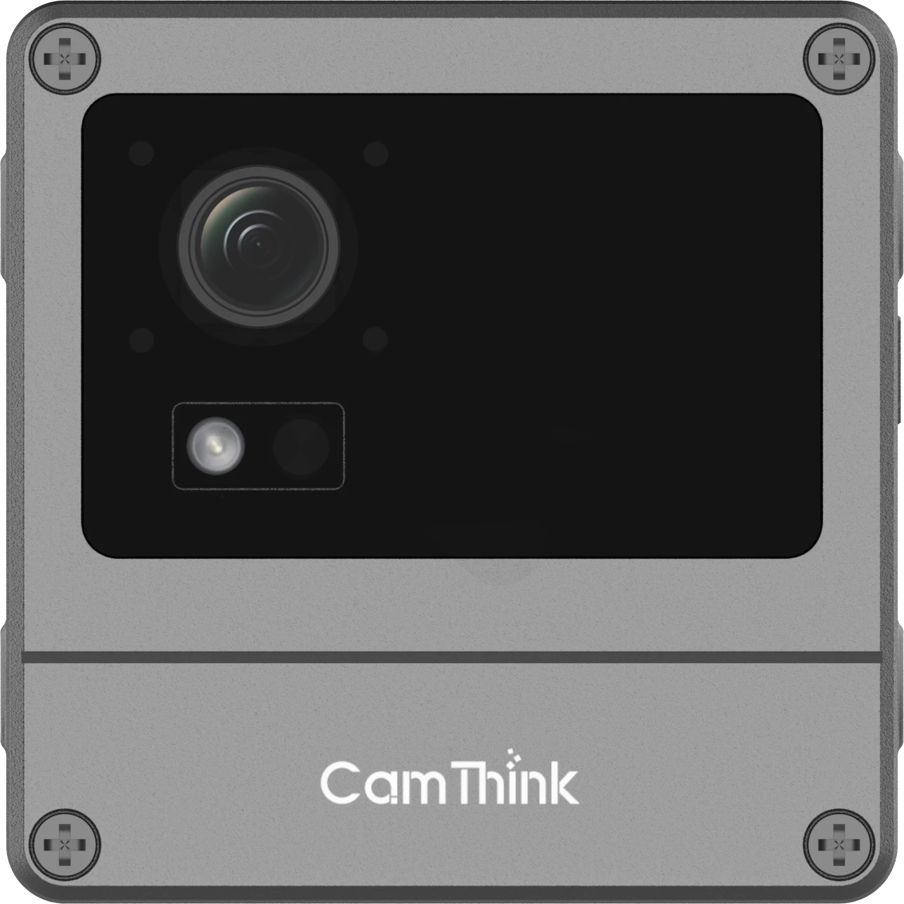
Use a dedicated camera when an important bay, row, or entrance is outside the useful installed views. The NeoEyes NE503 is a candidate for that point: it combines 4K imaging, Hailo-15H on-device inference capability, and an IP67 enclosure. Place it for the actual target distance and field of view, then apply the same occupancy event contract used by the rest of the site.
A mixed design can keep NG4500 on useful existing streams and place an NE503 at one high-value blind spot. The NE503 provides imaging and an application platform at that new point; the parking-specific model and rules are part of the project. The PoC confirms that its placement, power, network path, and event interface work together in the actual scene.
That view-led approach gives the customer a clear investment path: retain suitable CCTV, add a camera only where its image creates a usable new measurement, and expand after the pilot establishes event quality.
Send Events the Parking Platform Can Act On
Agree on the event contract with the platform team before the pilot. A useful proposed bay event has a site ID, camera or source ID, bay ID, state, observation time, state-change time, confidence or quality indicator, and an optional evidence reference. A zone or gate event needs its own area ID and direction or count fields. The parking guidance system can use a stable available or occupied change to update its map or sign; the event format is project-defined rather than a factory-default CamThink payload.
The platform should know when a value is current, stale, uncertain, or manually corrected. Otherwise a dashboard can display a plausible free-space count after the camera has stopped reporting. Define how duplicate events are handled and whether the consumer needs a full state snapshot after reconnect. For signs and customer apps, decide whether uncertain bays are excluded from availability rather than displayed as free.
Keep identity workflows separate. Occupancy answers whether a space or area is in use; it does not identify a plate, permit, account, or payment status. If the deployment also requires vehicle identification, plan and validate that as a separate subsystem. CamThink’s ANPR camera guide addresses that different requirement.
Validate the PoC Against Operating Conditions
Build the pilot around a few representative views, including the hardest one. Label short sequences with the true space or zone state and the time each state changes. Include empty and full periods, gradual filling, frequent turnover, stopped traffic, motorcycles or large vehicles if they are allowed, headlights, low light, weather, and partial obstruction. A balanced set is more useful than a large collection of easy daytime frames.
Evaluate the output the buyer will use. For bay status, count false available and false occupied periods, missed transitions, unstable toggles, and the time from a real change to a stable platform update. For a zone, compare the count against a manual audit at agreed intervals. For a gate, test reversing, tailgating, and missed crossings, then inspect how count drift is corrected. Record uncertain states separately so they do not disappear into an average accuracy number.
Set acceptance thresholds with the operator for the specific sign, dashboard, or workflow. The tolerance for a delayed floor-level count may differ from the tolerance for directing a driver to one named bay. Also test stream loss, reconnect, edge restarts, and platform replay. A successful PoC demonstrates the state and recovery behavior under agreed conditions.
Parking Occupancy PoC — Evaluation Checklist
Confirm whether the output is space-level, zone-level, or entry-exit occupancy.
Collect representative day and night footage from the intended camera streams.
Check field of view, occlusion, stream stability, and target visibility.
Define acceptable false-available events, transition delay, and uncertain states.
Verify how occupancy events reach the parking platform or VMS.
Common Questions Before a Parking Occupancy PoC
Can Existing CCTV Support Individual Parking Space Detection?
Yes, when each target bay remains visible enough to map its image region to a real space ID through normal traffic and lighting. If a camera supports only a row count or gate crossing, use that measurement instead of presenting it as individual-bay availability.
Does NG4500 Include a Ready-Made Parking Guidance System?
NG4500 provides a Jetson Orin edge platform for a site-specific occupancy application. The project supplies its detection and state logic, then connects stable events to the parking guidance system or VMS. A PoC shows how the selected cameras, application, and platform work together.
When Is a New NE503 Camera Worth Evaluating?
Evaluate NE503 when an important bay, row, or entry point is missing from the useful existing views. Its value is a purpose-placed image and local application endpoint for that gap, while suitable CCTV stays in service.
Choose the Deployment Path from the Evidence
What the site check shows
Next evaluation step
Existing fixed cameras clearly cover the required bays or lanes
Pilot the selected IP streams with NG4500 and the planned occupancy application.
Most views work, but a critical row or entrance is blind
Keep the usable CCTV path and evaluate an NE503 at the missing point.
Streams are accessible, but the required bays remain hidden or too small
Change the camera view or narrow the measurement before buying more compute.
A controlled gate can support counting, but individual bays cannot be seen
Test entry-exit occupancy as a different output and plan count reconciliation.
Use the site check to choose one measurable first pilot. Agree on the occupancy output and platform event contract before expanding to more cameras or spaces.
HH
Technical Director at CamThink
Harry Hua
Harry works on edge AI camera platforms, video analytics deployment, and the integration of embedded vision systems with operational workflows.
Share a site plan, sample day and night views, the spaces or zones to measure, and the output your parking platform needs. CamThink can help assess NG4500 for usable existing streams and NE503 where a new view is needed.